SMART Pathway
![]()
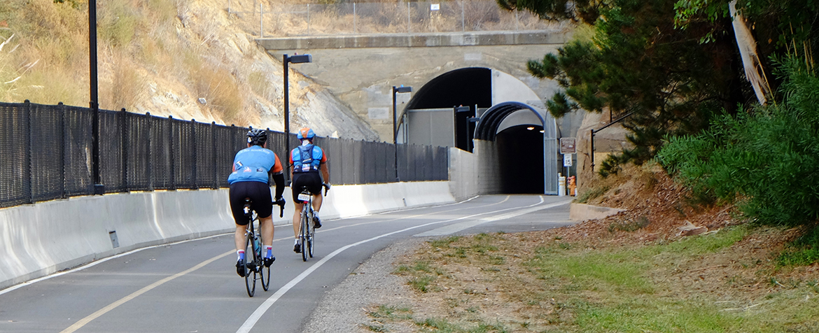
The SMART Pathway/Great Redwood Trail
The SMART Pathway/Great Redwood Trail provides first and last-mile connections to SMART Rail Stations and offers a dedicated facility for people to walk, bike, and roll safely within and between communities. Through the passage of Senate Bill (SB) 69 in 2021, the SMART Pathway officially became designated as the southern portion of the Great Redwood Trail. Once complete, the Great Redwood Trail will be a 307-mile multiuse path connecting California’s San Francisco and Humboldt Bays. For more information about the Great Redwood Trail, please find their website here.
To date, SMART along with partner agencies have constructed over 39 miles of pathway, of which approximately 29 miles are Class I SMART Pathway/Great Redwood Trail within and along the railroad right-of-way.
For more on the status of the pathway, and individual pathway segments, please see the interactive maps below.
| Pathway Segments in Construction | Length | Expected Completion |
| McInnis Parkway to Smith Ranch Road in San Rafael | 0.9 miles | Now open |
| South Point Boulevard to Main Street between Petaluma and Penngrove | 2.9 miles | Now open |
| Golf Course Drive to Bellevue Avenue between Rohnert Park and Santa Rosa | 2.8 miles | Now open |
| Airport Boulevard to Windsor Road between northern Santa Rosa and Windsor | 2.6 miles | Now open |
Pathway Rules
- Maintain a safe speed: 15 mph or less for all users, including e-bikes and e-scooters. To view our bike and scooter policy, click here.
- Yield to pedestrians: Always give the right of way to those on foot.
- Keep right, pass left: Announce yourself when passing.
- Leash your dog: Pets must be on a leash at all times.
- Clean up after animals: Remove pet waste, including from horses.
- Stay aware: Be mindful of your surroundings and others.
Interactive Pathway Map
New maps with improved legibility and updated information on the status of the SMART Pathway are available in two formats: printable maps in PDF format (see links below) and the online interactive map shown below.
SMART Pathway maps provide an overview of the SMART Pathway and provide information on completed segments as well as the current status of the pathway segments yet to be constructed.
Printable Pathway Maps
- Cloverdale to Healdsburg
- Windsor to Healdsburg
- Airport to Windsor
- Santa Rosa to Airport
- Rohnert Park to Santa Rosa
- Penngrove to Rohnert Park
- Petaluma to Penngrove
- Highway 37 to Petaluma
- Larkspur to Highway 37
- SMART Pathway Overview Map
The SMART Pathway maps are formatted to be printed as large as 11” x 17” (Ledger size).
Additional Information about the Pathway Map
The SMART Pathway map is meant to be a reference document for the community get information on the status and location of different pathway segments related to the SMART Pathway alignment. It is not meant to be a live navigation tool or a comprehensive map of all pathways along the SMART corridor. For these maps, we recommend those created and sold by the Sonoma County Bicycle Coalition (SCBC) and the Marin County Bicycle Coalition (MCBC).
For trip planning and navigation purposes, we recommend using Google or Apple Maps, or a sports mobile app like Strava. Our Planning department works with Google and Apple Maps to ensure our routes are accurately depicted.
The SMART Pathway shapefile is available for use by other jurisdictions. For a copy of the shapefile, please contact the Assistant Planner at (707) 794-3079.
These maps include select connecting facilities outside of SMART’s pathway alignment that offer alternative routes that can be used to connect between Pathway segments and SMART rail stations where a gap in the Pathway currently exists. The routes labeled “City/County Gap Closure” were selected using the following criteria:
- Routes are roughly parallel to the SMART Pathway alignment
- Routes are officially designated/labeled as a bicycle route by the local jurisdiction, with clear street markings if Class II or Class III
- If Class II, III, or IV, routes have lanes in both directions
- Preference for a single, straight route over multiple turns.